A FEW PICTURES FROM MY HIKING TRIP
I thought I'd share a few pictures of a hiking trip I took this past week in the Wallowa Mountains of NE Oregon. These pictures were all taken in the magnificent Eagle Cap Wilderness Area.

My 57-year-old body handled the trip. Getting in a lot of good exercise off and on during the last year helped a lot! My friend Rand and I hired some great people to haul our gear in for us on horseback, so we didn't have to carry more than what was in our daypacks, which was about 20 pounds each. We were camped about a quarter mile beyond Moccasin Lake.

The first day was an 8.5 mile walk to the camp site. There was an elevation gain of 1,600 feet in the first 2.5 miles, which is steep. After that it was pretty easy though, with a gain of 700 feet in the next 5 miles. The last mile and a half was up and down to an excellent (and remote) campsite our packers found for us:


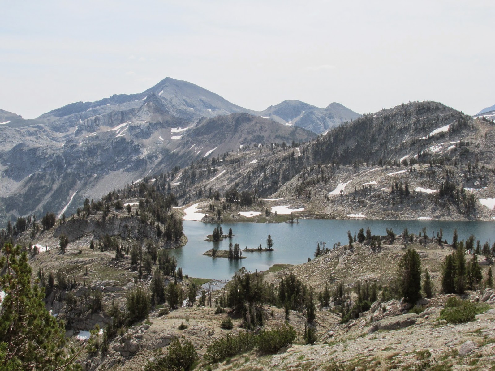
We hiked to Razz Lake on Day 2, a 900-foot climb in one mile after a 3-mile walk to where we left the main trail to head up the mountainside. We futzed around for a while trying to find the old trail to the lake, and finally found it about halfway up the hill after working our way up through steep hillsides and boulders. The lake is a gorgeous spot, and it was nice to see it again after being away for close to 30 years.

Razz Lake

Razz Lake
Day 3 featured an all-on-trail hike through Glacier Pass to Glacier Lake. It was a climb of 1,000 feet in about a mile and half, fairly steep to the pass. Another half mile and 400 feet down the other side and we were at Glacier Lake, another place I hadn't seen in years. On the way back we tried to replicate an off-trail side trip I did 40 years ago, and found that it looked pretty impossible... how did I do it way back then? We decided to save it for the next day.

The Matterhorn as seen looking north from the Glacier Pass trail

Me and Rand near the top of Glacier Pass
Glacier Lake as seen looking south from Glacier Pass

Glacier Lake


Rand at Glacier Pass
Pocket Lake was for Day 4. It was only about a 5-mile round trip, but none of it was on established
trails. The lake sits in a cirque 1,000 feet up a hillside strewn with boulders ranging in size from wastebaskets, chairs, and tables to VW bugs. There was a fair amount of scrambling near the top, including a section that involved crawling uphill along the top of a fairly high snowbank. But all that was worth it for the chance to spend some time at the lake. The way back down was marred by a couple of falls, but I got back to camp with nothing more than a sore shin and numerous rock scrapes.

Me at Pocket Lake

Pocket Lake


I got banged up but the trip to Pocket Lake and back was worth it!
On the last day the packers came to get our gear, and we hiked the 8.5 miles back to the trail head. All in all, it was worth the soreness. I was proud that I was able to do things that I think at least 80% of people my age would not be able to do, proving to myself that all the exercising I did during the past year has helped my strength and endurance. Fun stuff! :-)

My 57-year-old body handled the trip. Getting in a lot of good exercise off and on during the last year helped a lot! My friend Rand and I hired some great people to haul our gear in for us on horseback, so we didn't have to carry more than what was in our daypacks, which was about 20 pounds each. We were camped about a quarter mile beyond Moccasin Lake.
The first day was an 8.5 mile walk to the camp site. There was an elevation gain of 1,600 feet in the first 2.5 miles, which is steep. After that it was pretty easy though, with a gain of 700 feet in the next 5 miles. The last mile and a half was up and down to an excellent (and remote) campsite our packers found for us:
We hiked to Razz Lake on Day 2, a 900-foot climb in one mile after a 3-mile walk to where we left the main trail to head up the mountainside. We futzed around for a while trying to find the old trail to the lake, and finally found it about halfway up the hill after working our way up through steep hillsides and boulders. The lake is a gorgeous spot, and it was nice to see it again after being away for close to 30 years.
Razz Lake
Razz Lake
Day 3 featured an all-on-trail hike through Glacier Pass to Glacier Lake. It was a climb of 1,000 feet in about a mile and half, fairly steep to the pass. Another half mile and 400 feet down the other side and we were at Glacier Lake, another place I hadn't seen in years. On the way back we tried to replicate an off-trail side trip I did 40 years ago, and found that it looked pretty impossible... how did I do it way back then? We decided to save it for the next day.
The Matterhorn as seen looking north from the Glacier Pass trail
Me and Rand near the top of Glacier Pass
Glacier Lake as seen looking south from Glacier Pass
Glacier Lake
Rand at Glacier Pass
Pocket Lake was for Day 4. It was only about a 5-mile round trip, but none of it was on established
trails. The lake sits in a cirque 1,000 feet up a hillside strewn with boulders ranging in size from wastebaskets, chairs, and tables to VW bugs. There was a fair amount of scrambling near the top, including a section that involved crawling uphill along the top of a fairly high snowbank. But all that was worth it for the chance to spend some time at the lake. The way back down was marred by a couple of falls, but I got back to camp with nothing more than a sore shin and numerous rock scrapes.
Me at Pocket Lake
Pocket Lake
The area around Pocket Lake
I got banged up but the trip to Pocket Lake and back was worth it!
On the last day the packers came to get our gear, and we hiked the 8.5 miles back to the trail head. All in all, it was worth the soreness. I was proud that I was able to do things that I think at least 80% of people my age would not be able to do, proving to myself that all the exercising I did during the past year has helped my strength and endurance. Fun stuff! :-)
Eagle Cap Mountain as seen from the East Fork Lostine River Trail

